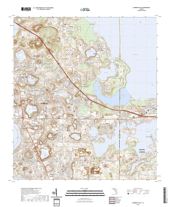
2024 Map of Clermont East
USGS Topo · Published 2024About this map
Clermont and its neighboring citrus-belt settlements occupy a high-relief landscape between the massive Lake Apopka and the Lake Minnehaha chain. This 2024 survey detail reveals a complex network of wetlands and upland ridges, where established communities like Oakland, Winter Garden, and Minneola have expanded around ancient water features such as Apopka Springs and Gourd Neck. The topography is particularly distinct at Orange Mountain and Castle Hill, rising above the numerous smaller basins like Lake Felter and Lake Avalon. Local history is anchored by sites like the Oakland Presbyterian Church and a series of burial grounds including Ferndale Cem and Williams Cem. The map also captures the modern academic presence of Lake-Sumter State College - South Lake Campus and the preserved environment of Lake Louisa State Park, illustrating the balance between rapid residential growth and the region's prominent hydraulic character.
Find a feature on this map
73 named features on this map. Tap any name to fly to it.
Don’t see what you’re looking for? This feature index may not catch every label — zoom into the map to look around manually.
Map Details
Editions of this 2024 Clermont East Map
This is the sole edition of this map. No revisions or reprints were ever made.
Other maps of this area

1953 · Windermere
USGS Topo · 1:24,000

1955 · Orlando
USGS Topo · 1:250,000

1956 · Winter Garden
USGS Topo · 1:24,000

1957 · Orlando
USGS Topo · 1:250,000

1958 · Orlando
USGS Topo · 1:250,000

1959 · Lake Nellie
USGS Topo · 1:24,000

1959 · Lake Louisa
USGS Topo · 1:24,000

1960 · Apopka
USGS Topo · 1:24,000

1962 · Orlando
USGS Topo · 1:250,000

1962 · Clermont East
USGS Topo · 1:24,000