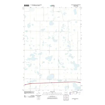
2011 Map of Cleveland NW
USGS Topo · Published 2011About this map
Runner Slough and a vast network of unnamed prairie potholes dominate this corner of Stutsman County, reflecting the glacial geomorphology typical of the Missouri Coteau. This modern topographic record shows a landscape primarily defined by its water management and section-line roads, such as 31st St SE and 60th Ave SE. The southern edge of the quadrangle marks the primary transportation corridor through the region, where County Rd-39 and Main St provide the few interruptions to the open wetlands. The distribution of these temporary and permanent water bodies, often bounded by the rigid grid of rural routes like 33rd St SE, illustrates the persistent challenge of agriculture and travel in this saturated terrain.
Find a feature on this map
18 named features on this map. Tap any name to fly to it.
Don’t see what you’re looking for? This feature index may not catch every label — zoom into the map to look around manually.
Map Details
Editions of this 2011 Cleveland NW Map
This is the sole edition of this map. No revisions or reprints were ever made.
Other maps of this area

1952 · New Rockford
USGS Topo · 1:250,000

1953 · Jamestown
USGS Topo · 1:250,000

1953 · Cleveland SE
USGS Topo · 1:24,000

1953 · Cleveland
USGS Topo · 1:24,000

1953 · Cleveland SW
USGS Topo · 1:24,000

1954 · Cleveland NW
USGS Topo · 1:24,000

1954 · Medina
USGS Topo · 1:24,000

1955 · Medina SE
USGS Topo · 1:24,000

1956 · New Rockford
USGS Topo · 1:250,000

1956 · Jamestown
USGS Topo · 1:250,000