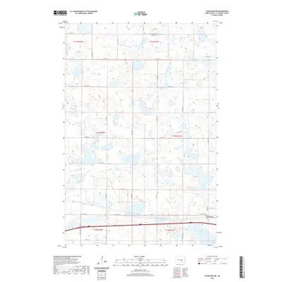
2020 Map of Cleveland NW
USGS Topo · Published 2020About this map
The settlement of Cleveland anchors the southeastern corner of this quadrangle, situated along a primary east-west transport corridor. This portion of the North Dakota prairie is defined by its glacial pothole geology, where numerous small, unnamed wetlands and basins dot the landscape. A prominent water feature, Runner Slough, occupies the southern reaches near the intersection of several sections. The map reveals the rigid organization of the Public Land Survey System, with township and range lines like t140n r67w and t141n r68w dividing the terrain into a clean grid of agricultural sections. Local heritage is preserved at sites like Cleveland Cem and Homes Cem, which serve as quiet landmarks for the rural population. Connectivity across this section of Stutsman County is maintained by a network of county roads including Co Hwy 68 and Co Rd 39.
Find a feature on this map
21 named features on this map. Tap any name to fly to it.
Don’t see what you’re looking for? This feature index may not catch every label — zoom into the map to look around manually.
Map Details
Editions of this 2020 Cleveland NW Map
This is the sole edition of this map. No revisions or reprints were ever made.
Other maps of this area

1952 · New Rockford
USGS Topo · 1:250,000

1953 · Jamestown
USGS Topo · 1:250,000

1953 · Cleveland SE
USGS Topo · 1:24,000

1953 · Cleveland
USGS Topo · 1:24,000

1953 · Cleveland SW
USGS Topo · 1:24,000

1954 · Cleveland NW
USGS Topo · 1:24,000

1954 · Medina
USGS Topo · 1:24,000

1955 · Medina SE
USGS Topo · 1:24,000

1956 · New Rockford
USGS Topo · 1:250,000

1956 · Jamestown
USGS Topo · 1:250,000