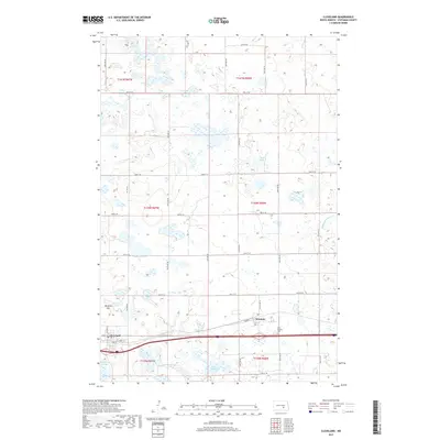
2017 Map of Cleveland
USGS Topo · Published 2017About this map
Cleveland and the nearby village of Windsor are the primary centers of settlement on this high-plains landscape, situated along the corridor of Interstate 94. The area is defined by its numerous glacial wetlands and depressions, including Bair Lake, Bair Slough, and Runner Slough, which break up the geometric grid of county roads and section lines. Notable landmarks include Terpena Hill to the west and the Saint Pauline Cem located just east of Windsor. This 2017 survey reflects the modern infrastructure of Stutsman County, showing the intersection of local routes like Co HWY 67 with the transcontinental highway system. The drainage patterns of Minneapolis Flats Cr in the southeast quadrant illustrate the subtle topography of the North Dakota prairie as it appeared in the late 2010s.
Find a feature on this map
32 named features on this map. Tap any name to fly to it.
Don’t see what you’re looking for? This feature index may not catch every label — zoom into the map to look around manually.
Map Details
Editions of this 2017 Cleveland Map
This is the sole edition of this map. No revisions or reprints were ever made.
Other maps of this area

1896 · Jamestown
USGS Topo · 1:125,000

1900 · Pingree
USGS Topo · 1:125,000

1900 · Pingree
USGS Topo · 1:62,500

1951 · Eldridge NW
USGS Topo · 1:24,000

1952 · Pingree SW
USGS Topo · 1:24,000

1952 · Eldridge SW
USGS Topo · 1:24,000

1952 · New Rockford
USGS Topo · 1:250,000

1953 · Jamestown
USGS Topo · 1:250,000

1953 · Cleveland SE
USGS Topo · 1:24,000

1953 · Cleveland
USGS Topo · 1:24,000