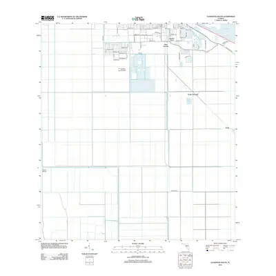
2012 Map of Clewiston South
USGS Topo · Published 2012About this map
Lake Okeechobee and its shoreline infrastructure dominate the northern edge of this landscape, where the Rim Canal serves as a critical boundary for the surrounding agricultural and industrial development. The area reflects its identity as a sugar-producing hub, with rail and road networks converging at Sugar Junction and Hooker Point. Moving south, the terrain transitions into a highly managed grid of drainage canals and fields, including the L-1 Canal. Scattered settlements such as South Clewiston and the landmark Maple Mound provide geographical anchors within the expansive lowlands. Modern utility development is also documented through the City of Clewiston Wastewater Treatment Facility, showcasing how the region’s water management and municipal services have evolved to support its population centers.
Find a feature on this map
50 named features on this map. Tap any name to fly to it.
Don’t see what you’re looking for? This feature index may not catch every label — zoom into the map to look around manually.
Map Details
Editions of this 2012 Clewiston South Map
This is the sole edition of this map. No revisions or reprints were ever made.
Other maps of this area

1956 · West Palm Beach
USGS Topo · 1:250,000

1957 · West Palm Beach
USGS Topo · 1:250,000

1958 · West Palm Beach
USGS Topo · 1:250,000

1970 · Lake Harbor
USGS Topo · 1:24,000

1970 · Lake Harbor SE
USGS Topo · 1:24,000

1970 · Moore Haven
USGS Topo · 1:24,000

1970 · Lake Harbor SW
USGS Topo · 1:24,000

1970 · Clewiston South
USGS Topo · 1:24,000

1970 · La Belle 4 SE
USGS Topo · 1:24,000

1970 · La Belle 4 NE
USGS Topo · 1:24,000