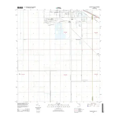
2015 Map of Clewiston South
USGS Topo · Published 2015About this map
Clewiston and its southern agricultural hinterlands are defined by a geometric grid of roads and drainage canals essential to the local sugar industry. The residential layout of Harlem and the industrial hub at Sugar Junction illustrate the town's role as a processing center on the edge of the Everglades. Moving south, the landscape shifts into a vast network of fields managed via the L-1 Canal and demarcated by long stretches of Evercane Rd. This environment is punctuated by solitary landmarks like Maple Mound and the rural settlement of Keela. The Florida National Scenic Trail winds through these corridors, offering a recreational contrast to the heavy transport infrastructure of Old US Hwy 27 and the various service roads that support the region's unique subtropical agriculture.
Find a feature on this map
51 named features on this map. Tap any name to fly to it.
Don’t see what you’re looking for? This feature index may not catch every label — zoom into the map to look around manually.
Map Details
Editions of this 2015 Clewiston South Map
This is the sole edition of this map. No revisions or reprints were ever made.
Other maps of this area

1956 · West Palm Beach
USGS Topo · 1:250,000

1957 · West Palm Beach
USGS Topo · 1:250,000

1958 · West Palm Beach
USGS Topo · 1:250,000

1970 · Lake Harbor
USGS Topo · 1:24,000

1970 · Lake Harbor SE
USGS Topo · 1:24,000

1970 · Moore Haven
USGS Topo · 1:24,000

1970 · Lake Harbor SW
USGS Topo · 1:24,000

1970 · Clewiston South
USGS Topo · 1:24,000

1970 · La Belle 4 SE
USGS Topo · 1:24,000

1970 · La Belle 4 NE
USGS Topo · 1:24,000