
1950 Map of Clifdale
USGS Topo · Published 1950About this map
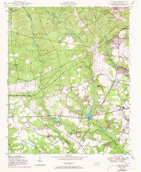
Fort Bragg Military Reservation dominates the northern landscape of this mid-century survey, where the boundary between federal military lands and the evolving rural community of Cumberland County is clearly delineated. The map details the transition from the active military grounds to the established agrarian and early residential pockets to the south. Local life is centered around institutions like 71st High School and the New Bethel Church, while the Aberdeen and Rockfish railroad provides a vital transportation link through Clifdale.
Find a feature on this map
31 named features on this map. Tap any name to fly to it.
Don’t see what you’re looking for? This feature index may not catch every label — zoom into the map to look around manually.
Map Details
Editions of this 1950 Clifdale Map
2 editions found
Other maps of this area

1948 · Fayetteville
USGS Topo · 1:62,500

1948 · Clifdale
USGS Topo · 1:62,500

1948 · Nicholson Creek
USGS Topo · 1:24,000

1948 · Clifdale
USGS Topo · 1:24,000

1950 · Lobelia
USGS Topo · 1:24,000

1950 · Fayetteville
USGS Topo · 1:24,000

1950 · Manchester
USGS Topo · 1:24,000

1950 · Nicholson Creek
USGS Topo · 1:24,000

1951 · Clifdale
USGS Topo · 1:62,500

1953 · Florence
USGS Topo · 1:250,000
Featured Places
- Fayetteville, NC
- Loch Lommond, Fayetteville
- Cliffdale, Fayetteville
- Fort Liberty, NC
- Emerald Gardens, Fayetteville