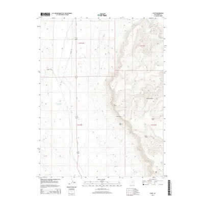
2014 Map of Cliff
USGS Topo · Published 2014About this map
The settlement of Cliff sits at the base of a dramatic geological transition, where the desert floor meets the rising elevations of the Book Cliffs. This 2014 survey captures a landscape defined by sharp vertical relief and arid-land water management, centered around Desert Reservoir Number 2. To the east, the terrain rises sharply into the high-altitude reaches of the Beckwith Plateau and Elliott Mesa. The Price River cuts through the northern section of the quadrangle, serving as a vital corridor in this desert environment. Between the peaks of Mt Elliott and Mid Mtn, the deep incision of Long Canyon illustrates the erosional forces that have shaped Emery County. For those tracing regional land use, the map clearly delineates township boundaries including t18s r14e and t19s r14e, showing the intersection of human surveying with the natural barriers of the western plateau.
Find a feature on this map
14 named features on this map. Tap any name to fly to it.
Don’t see what you’re looking for? This feature index may not catch every label — zoom into the map to look around manually.
Map Details
Editions of this 2014 Cliff Map
This is the sole edition of this map. No revisions or reprints were ever made.
Other maps of this area

1886 · Price River
USGS Topo · 1:250,000

1896 · Price River
USGS Topo · 1:250,000

1948 · Woodside
USGS Topo · 1:62,500

1949 · Woodside
USGS Topo · 1:62,500

1950 · Woodside
USGS Topo · 1:62,500

1953 · Beckwith Peak SW
USGS Topo · 1:24,000

1954 · Range Creek
USGS Topo · 1:62,500

1956 · Price
USGS Topo · 1:250,000

1960 · Price
USGS Topo · 1:250,000

1962 · Price
USGS Topo · 1:250,000