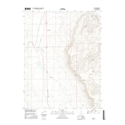
2017 Map of Cliff
USGS Topo · Published 2017About this map
Cliff sits at the base of a dramatic geological escarpment in this 2017 study of the Emery County landscape. The terrain is dominated by the massive Book Cliffs, which separate the lower desert floor from the elevated heights of the Beckwith Plateau and Elliott Mesa. Water management and historical transit routes define the valley below, where Desert Reservoir Number 2 provides a critical catchment point. The Moab to Boulder Town trail and S Woodside Hwy trace the flatlands, following the natural corridors formed by the surrounding peaks like Mt Elliott and Mid Mtn. In the northeastern corner, the Price River cuts through the desert, flanked by the Woodside Lower Price River Rd, illustrating the intersection of natural drainage and rural infrastructure in this high-desert environment.
Find a feature on this map
17 named features on this map. Tap any name to fly to it.
Don’t see what you’re looking for? This feature index may not catch every label — zoom into the map to look around manually.
Map Details
Editions of this 2017 Cliff Map
This is the sole edition of this map. No revisions or reprints were ever made.
Other maps of this area

1886 · Price River
USGS Topo · 1:250,000

1896 · Price River
USGS Topo · 1:250,000

1948 · Woodside
USGS Topo · 1:62,500

1949 · Woodside
USGS Topo · 1:62,500

1950 · Woodside
USGS Topo · 1:62,500

1953 · Beckwith Peak SW
USGS Topo · 1:24,000

1954 · Range Creek
USGS Topo · 1:62,500

1956 · Price
USGS Topo · 1:250,000

1960 · Price
USGS Topo · 1:250,000

1962 · Price
USGS Topo · 1:250,000