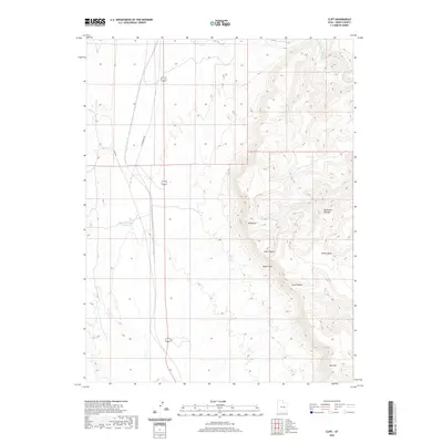
2020 Map of Cliff
USGS Topo · Published 2020About this map
The Book Cliffs rise sharply in this part of Emery County, defining a landscape of dramatic elevation changes and complex drainage systems. The eastern portion of the map is dominated by the massive Beckwith Plateau and Elliott Mesa, while the Price River cuts through the northeastern corner. This terrain forced a distinct infrastructure pattern, where transportation routes like S Woodside Hwy and Co Rd 401 are confined to the lower, flatter basins in the west. Local water management is visible through features like Desert Reservoir Number 2, essential for land use in this arid environment. The transition from the desert floor to the heights of Mt Elliott and Mid Mtn is carved by geological features such as Long Canyon, showing the natural erosion patterns of the Colorado Plateau region.
Find a feature on this map
10 named features on this map. Tap any name to fly to it.
Don’t see what you’re looking for? This feature index may not catch every label — zoom into the map to look around manually.
Map Details
Editions of this 2020 Cliff Map
This is the sole edition of this map. No revisions or reprints were ever made.
Other maps of this area

1886 · Price River
USGS Topo · 1:250,000

1896 · Price River
USGS Topo · 1:250,000

1948 · Woodside
USGS Topo · 1:62,500

1949 · Woodside
USGS Topo · 1:62,500

1950 · Woodside
USGS Topo · 1:62,500

1953 · Beckwith Peak SW
USGS Topo · 1:24,000

1954 · Range Creek
USGS Topo · 1:62,500

1956 · Price
USGS Topo · 1:250,000

1960 · Price
USGS Topo · 1:250,000

1962 · Price
USGS Topo · 1:250,000