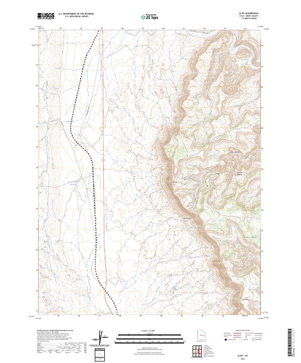
2023 Map of Cliff
USGS Topo · Published 2023About this map
The Book Cliffs dominate the eastern landscape of this Emery County region, creating a dramatic vertical transition between the high desert floor and the elevated terrain of Beckwith Plateau. This survey captures the sparse infrastructure of the modern era, centered on the S Woodside Hwy corridor and Co Rd 401, which navigate the basin below the massive escarpments. Water management in this arid environment is represented by Desert Reservoir Number 2, a vital landmark in an area defined by significant topographic features like Mt Elliott and Elliott Mesa. The mapping detail highlights the isolation and distinctive geology of Mid Mtn and the deep incision of Long Canyon, offering a precise view of how transportation and limited water resources are constrained by the sheer walls of the cliffs.
Find a feature on this map
9 named features on this map. Tap any name to fly to it.
Don’t see what you’re looking for? This feature index may not catch every label — zoom into the map to look around manually.
Map Details
Editions of this 2023 Cliff Map
This is the sole edition of this map. No revisions or reprints were ever made.
Other maps of this area

1886 · Price River
USGS Topo · 1:250,000

1896 · Price River
USGS Topo · 1:250,000

1948 · Woodside
USGS Topo · 1:62,500

1949 · Woodside
USGS Topo · 1:62,500

1950 · Woodside
USGS Topo · 1:62,500

1953 · Beckwith Peak SW
USGS Topo · 1:24,000

1954 · Range Creek
USGS Topo · 1:62,500

1956 · Price
USGS Topo · 1:250,000

1960 · Price
USGS Topo · 1:250,000

1962 · Price
USGS Topo · 1:250,000