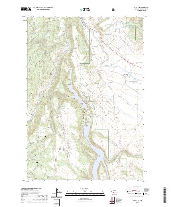
2024 Map of Cliff Lake
USGS Topo · Published 2024About this map
Wade Lake and Cliff Lake dominate this high-elevation landscape within the Beaverhead National Forest and Lee Metcalf Wilderness. This modern survey details the intricate system of glacial benches and ridges, including Wade Lake Bench and Cliff Lake Bench, that flank these narrow, deep water bodies. The terrain is marked by distinctive local names such as Soapbox, Frozen Soap, and Jackknife, suggesting a rugged history of ranching and land use in the shadow of the Horn Mountains. Drainage patterns are defined by the West Fork Madison River and the main Madison River, which are fed by numerous seasonal runs like Bogus Creek and Soap Creek. The presence of Antelope Prong and Missouri Flats at the southern edge indicates the transition from steep mountain ridges to more open plateau features, while specialized landmarks like the 11S02E32DCDC01 Spring note vital water sources in this high-country environment.
Find a feature on this map
59 named features on this map. Tap any name to fly to it.
Don’t see what you’re looking for? This feature index may not catch every label — zoom into the map to look around manually.
Map Details
Editions of this 2024 Cliff Lake Map
This is the sole edition of this map. No revisions or reprints were ever made.
Other maps of this area

1950 · Cliff Lake
USGS Topo · 1:62,500

1950 · Hebgen Dam
USGS Topo · 1:62,500

1950 · Upper Red Rock Lake
USGS Topo · 1:62,500

1955 · Ashton
USGS Topo · 1:250,000

1958 · Ashton
USGS Topo · 1:250,000

1960 · Ashton
USGS Topo · 1:250,000

1964 · Targhee Peak
USGS Topo · 1:24,000

1964 · Henrys Lake
USGS Topo · 1:62,500
1988 · Granite Mountain
USGS Topo · 1:24,000
1988 · Hidden Lake Bench
USGS Topo · 1:24,000