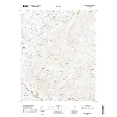
2019 Map of Cliffield Mountain
USGS Topo · Published 2019About this map
The Narrows and the Hungry River carve through the high elevations of the Blue Ridge, defining a landscape where isolated settlements and family burial grounds are tucked into gaps and along ridges. This part of the western North Carolina mountains is characterized by steep summits like Cliffield Mtn and Raccoon Mtn, which separate the drainages of the Little Hungry River and Green River. The map documents a cluster of faith-based communities around Dana and Union Hill, each anchored by historical institutions such as the Union Hill Holiness Baptist Church and several associated graveyards.
Find a feature on this map
183 named features on this map. Tap any name to fly to it.
Don’t see what you’re looking for? This feature index may not catch every label — zoom into the map to look around manually.
Map Details
Editions of this 2019 Cliffield Mountain Map
This is the sole edition of this map. No revisions or reprints were ever made.
Other maps of this area

1907 · Saluda
USGS Topo · 1:125,000

1935 · Batcave
USGS Topo · 1:24,000

1935 · Hendersonville
USGS Topo · 1:24,000

1935 · Fishtop
USGS Topo · 1:24,000

1935 · Zirconia
USGS Topo · 1:24,000

1936 · Fruitland
USGS Topo · 1:24,000

1942 · Fruitland
USGS Topo · 1:24,000

1946 · Zirconia
USGS Topo · 1:24,000

1946 · Bat Cave
USGS Topo · 1:24,000
1946 · Hendersonville
USGS Topo · 1:24,000