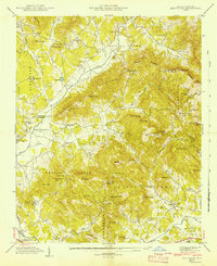
1942 Map of Fruitland
USGS Topo · Published 1942About this map
The Asheville-Hendersonville Airport and the Mountain Sanitarium anchor this mid-century look at the landscape south of the Buncombe and Henderson county line. The terrain is defined by a series of prominent peaks and gaps, including Burney Mountain and Stroupe Gap, which dictate the paths of numerous waterways like Cane Creek and Hooper Creek.
Find a feature on this map
87 named features on this map. Tap any name to fly to it.
Don’t see what you’re looking for? This feature index may not catch every label — zoom into the map to look around manually.
Map Details
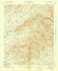
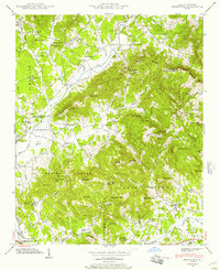
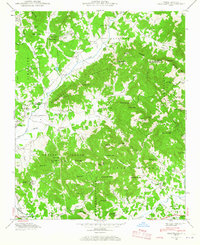
Editions of this 1942 Fruitland Map
4 editions found
Other maps of this area

1894 · Asheville
USGS Topo · 1:125,000

1900 · Mount Mitchell
USGS Topo · 1:125,000

1901 · Asheville
USGS Topo · 1:125,000

1902 · Mount Mitchell
USGS Topo · 1:125,000

1905 · Pisgah
USGS Topo · 1:125,000

1906 · Pisgah
USGS Topo · 1:125,000

1907 · Saluda
USGS Topo · 1:125,000

1935 · Horse Shoe
USGS Topo · 1:24,000

1935 · Batcave
USGS Topo · 1:24,000

1935 · Hendersonville
USGS Topo · 1:24,000