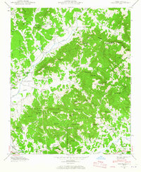
1942 Map of Fruitland
USGS Topo · Published 1965About this map
The Buncombe and Henderson County border runs through this 1942 field examination, revealing a landscape defined by the transition from aviation infrastructure to high Appalachian ridges. The presence of the Asheville-Hendersonville Airport near Fletcher and the Mountain Sanitarium highlights the region's developing mid-century public health and transportation roles. In the lower-lying valleys, industrial sites like the Kilns near the Southern railroad track hint at local manufacturing.
Find a feature on this map
84 named features on this map. Tap any name to fly to it.
Don’t see what you’re looking for? This feature index may not catch every label — zoom into the map to look around manually.
Map Details
Editions of this 1942 Fruitland Map
4 editions found

Other maps of this area

1894 · Asheville
USGS Topo · 1:125,000

1900 · Mount Mitchell
USGS Topo · 1:125,000

1901 · Asheville
USGS Topo · 1:125,000

1902 · Mount Mitchell
USGS Topo · 1:125,000

1905 · Pisgah
USGS Topo · 1:125,000

1906 · Pisgah
USGS Topo · 1:125,000

1907 · Saluda
USGS Topo · 1:125,000

1935 · Horse Shoe
USGS Topo · 1:24,000

1935 · Batcave
USGS Topo · 1:24,000

1935 · Hendersonville
USGS Topo · 1:24,000