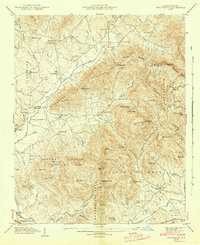
1942 Map of Fruitland
USGS Topo · Published 1942About this map
Fruitland and the surrounding Blue Ridge highlands are captured in this 1942 Tennessee Valley Authority and Geological Survey collaboration. The map illustrates a landscape transitioning from the traditional mountain economy toward early aviation and regional healthcare. The Asheville-Hendersonville Airport sits in the valley near Fletcher, while the Mountain Sanitarium and Christ Sch indicate the growth of institutional land use.
Find a feature on this map
86 named features on this map. Tap any name to fly to it.
Don’t see what you’re looking for? This feature index may not catch every label — zoom into the map to look around manually.
Map Details
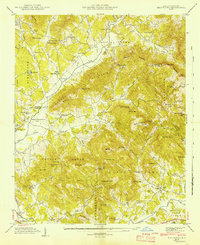
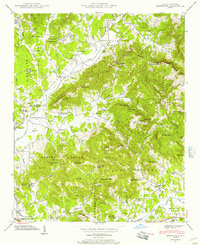
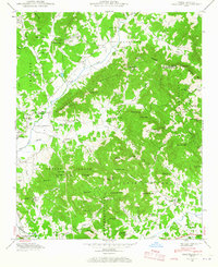
Editions of this 1942 Fruitland Map
4 editions found
Other maps of this area

1894 · Asheville
USGS Topo · 1:125,000

1900 · Mount Mitchell
USGS Topo · 1:125,000

1901 · Asheville
USGS Topo · 1:125,000

1902 · Mount Mitchell
USGS Topo · 1:125,000

1905 · Pisgah
USGS Topo · 1:125,000

1906 · Pisgah
USGS Topo · 1:125,000

1907 · Saluda
USGS Topo · 1:125,000

1935 · Horse Shoe
USGS Topo · 1:24,000

1935 · Batcave
USGS Topo · 1:24,000

1935 · Hendersonville
USGS Topo · 1:24,000