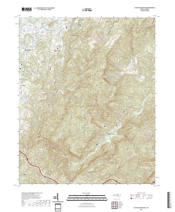
2022 Map of Cliffield Mountain
USGS Topo · Published 2022About this map
Union Hill and the surrounding high country of the Blue Ridge define this corner of Western North Carolina, where the landscape is marked by numerous family cemeteries and small rural congregations. The terrain is structured by the Tennessee Valley Divide, with waters like the Little Hungry River and Hungry River carving through the highlands near peaks such as Cliffield Mtn and Pilot Mtn. For genealogists, the map is remarkably dense with burial sites and house of worship markers, including the Union Hill Holiness Baptist Church-Graveyard and Dana Baptist Church-Graveyard.
Find a feature on this map
166 named features on this map. Tap any name to fly to it.
Don’t see what you’re looking for? This feature index may not catch every label — zoom into the map to look around manually.
Map Details
Editions of this 2022 Cliffield Mountain Map
This is the sole edition of this map. No revisions or reprints were ever made.
Other maps of this area

1907 · Saluda
USGS Topo · 1:125,000

1935 · Batcave
USGS Topo · 1:24,000

1935 · Hendersonville
USGS Topo · 1:24,000

1935 · Fishtop
USGS Topo · 1:24,000

1935 · Zirconia
USGS Topo · 1:24,000

1936 · Fruitland
USGS Topo · 1:24,000

1942 · Fruitland
USGS Topo · 1:24,000

1946 · Zirconia
USGS Topo · 1:24,000

1946 · Bat Cave
USGS Topo · 1:24,000
1946 · Hendersonville
USGS Topo · 1:24,000