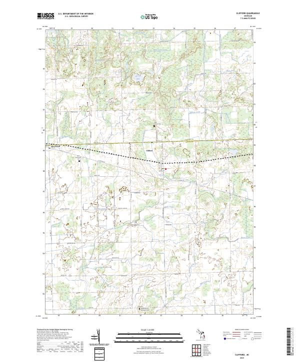
2023 Map of Clifford
USGS Topo · Published 2023About this map
Clifford and Silverwood anchor this agricultural landscape along the border of Tuscola and Lapeer counties. The terrain is defined by an intricate network of water management features, including the South Clifford Drain, Slattery Drain, and McKillop Drain, which navigate the subtle elevations of the Michigan thumb region. This 2023 survey illustrates how modern drainage systems continue to shape the land around natural features like Becroft Lake and Indian Creek. Local heritage is preserved in the area's rural burial grounds, such as Saint Patricks Cem and the West Burlington Cem. The map's grid-like road system, featuring Marlette Rd and Mayville Rd, reflects the longstanding agrarian organization of the townships, providing a clear view of the region's contemporary rural structure and environmental management.
Find a feature on this map
51 named features on this map. Tap any name to fly to it.
Don’t see what you’re looking for? This feature index may not catch every label — zoom into the map to look around manually.
Map Details
Editions of this 2023 Clifford Map
This is the sole edition of this map. No revisions or reprints were ever made.
Other maps of this area

1954 · Flint
USGS Topo · 1:250,000

1958 · Flint
USGS Topo · 1:250,000

1963 · Clifford
USGS Topo · 1:24,000

1963 · East Dayton
USGS Topo · 1:24,000

1963 · Mayville
USGS Topo · 1:24,000

1963 · Marlette
USGS Topo · 1:24,000

1963 · North Branch
USGS Topo · 1:24,000

1963 · Kingston
USGS Topo · 1:24,000

1963 · Burnside
USGS Topo · 1:24,000
1963 · Decker
USGS Topo · 1:24,000