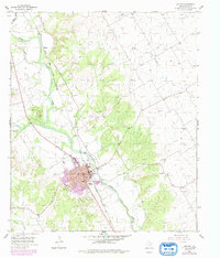
1955 Map of Clifton
USGS Topo · Published 1979About this map
The Bosque River valley anchors this mid-century portrait of Central Texas, where the town of Clifton serves as a regional hub for the surrounding ranching and farming landscape. The town's grid is defined by the Atchison Topeka and Santa Fe railroad, which runs parallel to the river and highway corridors. Evidence of a robust community life is found in features like the Mermaid Swimming Pool, the Rodeo Grounds, and the Clifton Municipal Airport.
Find a feature on this map
27 named features on this map. Tap any name to fly to it.
Don’t see what you’re looking for? This feature index may not catch every label — zoom into the map to look around manually.
Map Details
Editions of this 1955 Clifton Map
2 editions found
Other maps of this area

1888 · Meridian
USGS Topo · 1:125,000

1892 · Waco
USGS Topo · 1:125,000

1894 · Meridian
USGS Topo · 1:125,000

1920 · Waco
USGS Topo · 1:125,000

1924 · Waco 2-b
USGS Topo · 1:48,000

1931 · Whitney
USGS Topo · 1:62,500

1931 · Valley Mills
USGS Topo · 1:62,500

1954 · Waco
USGS Topo · 1:250,000

1955 · Waco
USGS Topo · 1:250,000

1955 · Clifton
USGS Topo · 1:24,000