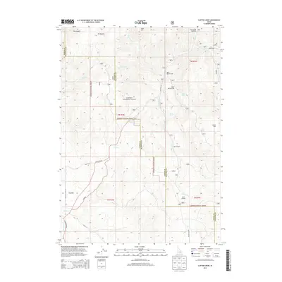
2013 Map of Clifton Creek
USGS Topo · Published 2013About this map
Caribou National Forest dominates the terrain of this quadrangle, where the Power and Bannock County line divides a landscape of high meadows and deep draws. The drainage network is defined by Clifton Creek and several branches of Mink Creek, including the West Fork and South Fork. Human activity centers on the small settlement of Crystal in the southwest and Justice Park to the east, connected by a network of forest roads such as South Mink Creek Road and Myler Road. Several natural springs, including Corral Spring, Blind Spring, and Valve House Spring, are marked alongside distinct topographical features like Slate Mountain and the expansive Elk Meadows. The inclusion of the Cherry Springs Campground highlights the area's use for recreation within the national forest system.
Find a feature on this map
36 named features on this map. Tap any name to fly to it.
Don’t see what you’re looking for? This feature index may not catch every label — zoom into the map to look around manually.
Map Details
Editions of this 2013 Clifton Creek Map
This is the sole edition of this map. No revisions or reprints were ever made.
Other maps of this area

1934 · Michaud
USGS Topo · 1:62,500

1937 · Pocatello
USGS Topo · 1:48,000

1937 · Michaud
USGS Topo · 1:62,500

1938 · Pauline
USGS Topo · 1:48,000

1944 · Pocatello
USGS Topo · 1:62,500

1944 · Arbon
USGS Topo · 1:62,500

1954 · Pocatello
USGS Topo · 1:250,000

1958 · Pocatello
USGS Topo · 1:250,000

1968 · Hawkins
USGS Topo · 1:24,000

1968 · Clifton Creek
USGS Topo · 1:24,000