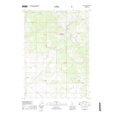
2020 Map of Clifton Creek
USGS Topo · Published 2020About this map
Caribou National Forest dominates this landscape in southern Idaho, where the intersection of Bannock Co and Power County boundaries meets a network of drainages and high peaks. The small settlement of Crystal and the Justice Park area serve as the primary human touchpoints in a terrain defined by steep canyons and named draws. Natural water sources are frequent throughout the highlands, including Elk Meadows, Blind Spring, and Corral Spring, which likely supported early ranching and forestry efforts.
Find a feature on this map
49 named features on this map. Tap any name to fly to it.
Don’t see what you’re looking for? This feature index may not catch every label — zoom into the map to look around manually.
Map Details
Editions of this 2020 Clifton Creek Map
This is the sole edition of this map. No revisions or reprints were ever made.
Other maps of this area

1934 · Michaud
USGS Topo · 1:62,500

1937 · Pocatello
USGS Topo · 1:48,000

1937 · Michaud
USGS Topo · 1:62,500

1938 · Pauline
USGS Topo · 1:48,000

1944 · Pocatello
USGS Topo · 1:62,500

1944 · Arbon
USGS Topo · 1:62,500

1954 · Pocatello
USGS Topo · 1:250,000

1958 · Pocatello
USGS Topo · 1:250,000

1968 · Hawkins
USGS Topo · 1:24,000

1968 · Clifton Creek
USGS Topo · 1:24,000