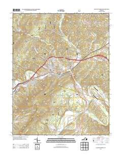
2013 Map of Clifton Forge
USGS Topo · Published 2013About this map
Clifton Forge serves as the central hub of this Alleghany County landscape, where the Jackson River cuts through the mountains near Iron Gate. The industrial heritage of the region is evident in landmarks like Callie Furnace and the winding course of the James River as it forms near the confluence of the Jackson and Coupasture River. The terrain is defined by significant ridges and gaps, including McGraw Gap to the north and the prominent Waits Mountain overlooking the river valleys.
Find a feature on this map
75 named features on this map. Tap any name to fly to it.
Don’t see what you’re looking for? This feature index may not catch every label — zoom into the map to look around manually.
Map Details
Editions of this 2013 Clifton Forge Map
This is the sole edition of this map. No revisions or reprints were ever made.
Other maps of this area

1894 · Natural Bridge
USGS Topo · 1:125,000

1894 · Natural Bridge
USGS Topo · 1:62,500

1907 · Natural Bridge Special
USGS Topo · 1:62,500

1913 · Eagle Rock
USGS Topo · 1:48,000

1915 · Eagle Rock
USGS Topo · 1:62,500

1929 · Falling Spring
USGS Topo · 1:24,000

1931 · Healing Springs
USGS Topo · 1:24,000

1932 · Falling Spring
USGS Topo · 1:31,680

1933 · Healing Springs
USGS Topo · 1:31,680

1945 · Clifton Forge
USGS Topo · 1:62,500