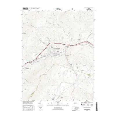
2016 Map of Clifton Forge
USGS Topo · Published 2016About this map
Clifton Forge sits at a strategic mountain gap where the Jackson River passes through the valley, surrounded by the extensive George Washington National Forest. The local geography is defined by the steep ridges of the Rich Patch Mountains and Fore Mtn, which funnel development into narrow corridors along the river and rail lines. This concentration of settlement is visible in the string of communities including Fairview Heights, Selma, and Low Moor.
Find a feature on this map
71 named features on this map. Tap any name to fly to it.
Don’t see what you’re looking for? This feature index may not catch every label — zoom into the map to look around manually.
Map Details
Editions of this 2016 Clifton Forge Map
This is the sole edition of this map. No revisions or reprints were ever made.
Other maps of this area

1894 · Natural Bridge
USGS Topo · 1:125,000

1894 · Natural Bridge
USGS Topo · 1:62,500

1907 · Natural Bridge Special
USGS Topo · 1:62,500

1913 · Eagle Rock
USGS Topo · 1:48,000

1915 · Eagle Rock
USGS Topo · 1:62,500

1929 · Falling Spring
USGS Topo · 1:24,000

1931 · Healing Springs
USGS Topo · 1:24,000

1932 · Falling Spring
USGS Topo · 1:31,680

1933 · Healing Springs
USGS Topo · 1:31,680

1945 · Clifton Forge
USGS Topo · 1:62,500