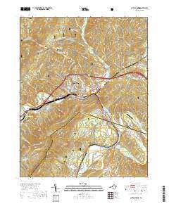
2019 Map of Clifton Forge
USGS Topo · Published 2019About this map
The Jackson River and James River converge in this industrial and mountainous region of the George Washington National Forest. The rail-focused economy of Clifton Forge is anchored by the C & O line, which follows the river valleys through narrow passages like Rainbow Gap. Significant for local genealogy, the area contains several established burial grounds, including Oakland Grove Presbyterian Cem and Mountain View Cem. To the east, the Cowpasture River flows through the Soldiers Retreat Valley, a landscape shaped by both the river and the surrounding Rich Patch Mountains. Notable transportation infrastructure includes the Robert F Craft Memorial Bridge and small aviation fields like Riverwood Airport, while historical industrial roots are reflected in names such as Longdale Furnace Rd.
Find a feature on this map
113 named features on this map. Tap any name to fly to it.
Don’t see what you’re looking for? This feature index may not catch every label — zoom into the map to look around manually.
Map Details
Editions of this 2019 Clifton Forge Map
This is the sole edition of this map. No revisions or reprints were ever made.
Other maps of this area

1894 · Natural Bridge
USGS Topo · 1:125,000

1894 · Natural Bridge
USGS Topo · 1:62,500

1907 · Natural Bridge Special
USGS Topo · 1:62,500

1913 · Eagle Rock
USGS Topo · 1:48,000

1915 · Eagle Rock
USGS Topo · 1:62,500

1929 · Falling Spring
USGS Topo · 1:24,000

1931 · Healing Springs
USGS Topo · 1:24,000

1932 · Falling Spring
USGS Topo · 1:31,680

1933 · Healing Springs
USGS Topo · 1:31,680

1945 · Clifton Forge
USGS Topo · 1:62,500