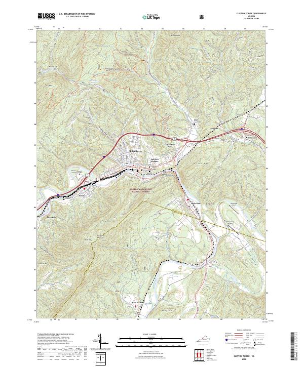
2022 Map of Clifton Forge
USGS Topo · Published 2022About this map
Clifton Forge serves as the centerpiece of this Virginia mountain landscape, where the confluence of the Jackson River and the Cowpasture River forms the headwaters of the James River. The map details a high-density corridor of settlements including Selma, Cliftondale Park, and Iron Gate, all positioned along the narrow valley floors between the Rich Patch Mountains and Wilson Mtn. The transport network is particularly expressive here, with Railroad Ave and numerous state routes tracing the winding riverbanks through Rainbow Gap.
Find a feature on this map
88 named features on this map. Tap any name to fly to it.
Don’t see what you’re looking for? This feature index may not catch every label — zoom into the map to look around manually.
Map Details
Editions of this 2022 Clifton Forge Map
This is the sole edition of this map. No revisions or reprints were ever made.
Other maps of this area

1894 · Natural Bridge
USGS Topo · 1:125,000

1894 · Natural Bridge
USGS Topo · 1:62,500

1907 · Natural Bridge Special
USGS Topo · 1:62,500

1913 · Eagle Rock
USGS Topo · 1:48,000

1915 · Eagle Rock
USGS Topo · 1:62,500

1929 · Falling Spring
USGS Topo · 1:24,000

1931 · Healing Springs
USGS Topo · 1:24,000

1932 · Falling Spring
USGS Topo · 1:31,680

1933 · Healing Springs
USGS Topo · 1:31,680

1945 · Clifton Forge
USGS Topo · 1:62,500