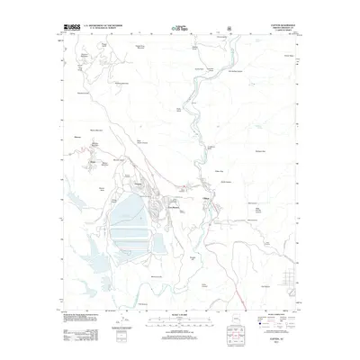
2011 Map of Clifton
USGS Topo · Published 2011About this map
The San Francisco River cuts a deep path through the copper-rich highlands of Greenlee County, framing the industrial and residential landscape of Clifton and Morenci. This 2011 survey documents the massive footprint of the mining operations that define the area, most notably the Tailings Water Reclamation Reservoir and the tiered residential developments of Plantsite, East Plantsite, and Stargo. For genealogists and local historians, the map is remarkably dense with burial sites, including Bunkers Cemetery, Clifton Catholic Cemetery, Metcalf Cemetery, and the main Clifton Cemetery located south of the town center.
Find a feature on this map
76 named features on this map. Tap any name to fly to it.
Don’t see what you’re looking for? This feature index may not catch every label — zoom into the map to look around manually.
Map Details
Editions of this 2011 Clifton Map
This is the sole edition of this map. No revisions or reprints were ever made.
Other maps of this area

1902 · Clifton
USGS Topo · 1:62,500

1913 · Morenci
USGS Topo · 1:125,000

1915 · Morenci
USGS Topo · 1:125,000

1954 · Silver City
USGS Topo · 1:250,000

1954 · Clifton
USGS Topo · 1:250,000

1957 · Clifton
USGS Topo · 1:250,000

1958 · Silver City
USGS Topo · 1:250,000

1958 · Clifton
USGS Topo · 1:250,000

1959 · York Valley
USGS Topo · 1:62,500

1960 · Guthrie
USGS Topo · 1:62,500