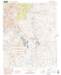
1989 Map of Clifton
USGS Topo · Published 1990About this map
Clifton and the industrial landscapes of eastern Arizona dominate this late 20th-century survey, centered on the steep canyons of the San Francisco River. The area is defined by the massive Morenci Pit and a complex network of mining infrastructure, including an Aerial Tramway and extensive Tailings Ponds south of the main operations. The rugged terrain is punctuated by significant peaks like Copper King Mountain and Markeen Mountain, while the human history of the district is preserved in several scattered burial grounds, including the Metcalf Cem, Clifton Cem, and Bunkers Cem.
Find a feature on this map
77 named features on this map. Tap any name to fly to it.
Don’t see what you’re looking for? This feature index may not catch every label — zoom into the map to look around manually.
Map Details
Editions of this 1989 Clifton Map
This is the sole edition of this map. No revisions or reprints were ever made.
Other maps of this area

1902 · Clifton
USGS Topo · 1:62,500

1913 · Morenci
USGS Topo · 1:125,000

1915 · Morenci
USGS Topo · 1:125,000

1954 · Silver City
USGS Topo · 1:250,000

1954 · Clifton
USGS Topo · 1:250,000

1957 · Clifton
USGS Topo · 1:250,000

1958 · Silver City
USGS Topo · 1:250,000

1958 · Clifton
USGS Topo · 1:250,000

1959 · York Valley
USGS Topo · 1:62,500

1960 · Guthrie
USGS Topo · 1:62,500