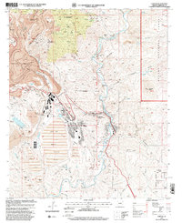
1997 Map of Clifton
USGS Topo · Published 2000About this map
The industrial scale of the Morenci Pit dominates this late-twentieth-century landscape, illustrating the massive open-pit mining operations that transformed the terrain near Morenci and Clifton. The map documents a complex industrial infrastructure of conveyors, aerial tramways, and extensive tailings ponds that fill the canyons south of Stargo. While the copper industry reshaped the earth, older layers of settlement persist at Metcalf and the Metcalf Cemetery, providing vital records for genealogists tracing family roots in this mining district.
Find a feature on this map
68 named features on this map. Tap any name to fly to it.
Don’t see what you’re looking for? This feature index may not catch every label — zoom into the map to look around manually.
Map Details
Editions of this 1997 Clifton Map
This is the sole edition of this map. No revisions or reprints were ever made.
Other maps of this area

1902 · Clifton
USGS Topo · 1:62,500

1913 · Morenci
USGS Topo · 1:125,000

1915 · Morenci
USGS Topo · 1:125,000

1954 · Silver City
USGS Topo · 1:250,000

1954 · Clifton
USGS Topo · 1:250,000

1957 · Clifton
USGS Topo · 1:250,000

1958 · Silver City
USGS Topo · 1:250,000

1958 · Clifton
USGS Topo · 1:250,000

1959 · York Valley
USGS Topo · 1:62,500

1960 · Guthrie
USGS Topo · 1:62,500