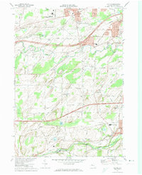
1971 Map of Clifton
USGS Topo · Published 1974About this map
Oatka Creek and Black Creek define the drainage of this Monroe County landscape, which shows a mix of suburban growth and persisting agricultural character in the early 1970s. The northern sector is anchored by North Chili, home to Roberts Wesleyan College and the Churchville-Chili High Sch. Transportation corridors like the New York State Thruway and the Penn Central railroad cut across the terrain, while the southern portion near Scottsville retains a more rural, industrial feel with numerous Gravel Pits and the Baltimore and Ohio line.
Find a feature on this map
65 named features on this map. Tap any name to fly to it.
Don’t see what you’re looking for? This feature index may not catch every label — zoom into the map to look around manually.
Map Details
Editions of this 1971 Clifton Map
Other maps of this area

1895 · Rochester
USGS Topo · 1:62,500

1898 · Rochester
USGS Topo · 1:62,500

1899 · Brockport
USGS Topo · 1:62,500

1901 · Honeoye
USGS Topo · 1:62,500

1904 · Caledonia
USGS Topo · 1:62,500

1904 · Honeoye
USGS Topo · 1:62,500

1912 · Rochester
USGS Topo · 1:62,500

1920 · Rochester
USGS Topo · 1:62,500

1931 · Rochester West
USGS Topo · 1:24,000

1932 · Spencerport
USGS Topo · 1:24,000