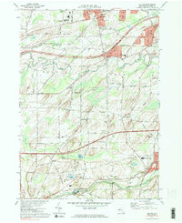
1971 Map of Clifton
USGS Topo · Published 1983About this map
The town of Chili and its surrounding hamlets are defined by a complex network of waterways and early 1970s transportation infrastructure. The New York State Thruway cuts through the center of the landscape, bypassing established settlements like Clifton and North Chili. To the north, the Penn Central rail line runs parallel to Telephone Road, while the southern reaches near Garbutt and Scottsville are influenced by the winding course of Oatka Creek. Educational and civic life is anchored by Roberts Wesleyan College and the Churchville-Chili High School. Land use in this era shows a transition from agricultural fields to recreational spaces, evidenced by the development of Black Creek Park and the Chili Country Club. Small clusters of industry and utility are visible at the Fish Hatchery and several Gravel Pits, reflecting the regional reliance on local natural resources and water management.
Find a feature on this map
81 named features on this map. Tap any name to fly to it.
Don’t see what you’re looking for? This feature index may not catch every label — zoom into the map to look around manually.
Map Details
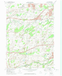
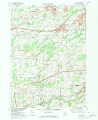
Editions of this 1971 Clifton Map
Other maps of this area

1895 · Rochester
USGS Topo · 1:62,500

1898 · Rochester
USGS Topo · 1:62,500

1899 · Brockport
USGS Topo · 1:62,500

1901 · Honeoye
USGS Topo · 1:62,500

1904 · Caledonia
USGS Topo · 1:62,500

1904 · Honeoye
USGS Topo · 1:62,500

1912 · Rochester
USGS Topo · 1:62,500

1920 · Rochester
USGS Topo · 1:62,500

1931 · Rochester West
USGS Topo · 1:24,000

1932 · Spencerport
USGS Topo · 1:24,000