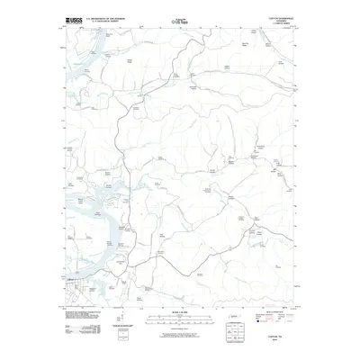
2010 Map of Clifton
USGS Topo · Published 2010About this map
The Tennessee River defines the western edge of this Wayne County landscape, where the town of Clifton serves as a primary hub. The river's influence is evident in the numerous historical points of access, including Clifton Ferry, Lego Landing, Glenkirk Landing, and Penny Slough Landing. These landings, along with Hassell Field, highlight the area's reliance on waterborne transport and local aviation. The terrain is deeply dissected by numerous watercourses such as Whiteoak Creek, Beech Creek, and Morrison Creek, which have carved out a complex system of hollows and ridges.
Find a feature on this map
118 named features on this map. Tap any name to fly to it.
Don’t see what you’re looking for? This feature index may not catch every label — zoom into the map to look around manually.
Map Details
Editions of this 2010 Clifton Map
This is the sole edition of this map. No revisions or reprints were ever made.
Other maps of this area

1905 · Waynesboro
USGS Topo · 1:125,000

1936 · Eagle Creek
USGS Topo · 1:24,000

1936 · Olivehill
USGS Topo · 1:24,000

1936 · Bath Springs
USGS Topo · 1:24,000

1936 · Linden
USGS Topo · 1:24,000

1936 · Leatherwood
USGS Topo · 1:24,000

1936 · Clifton
USGS Topo · 1:24,000

1936 · Perryville
USGS Topo · 1:24,000

1936 · Waynesboro
USGS Topo · 1:24,000

1936 · Pope
USGS Topo · 1:24,000