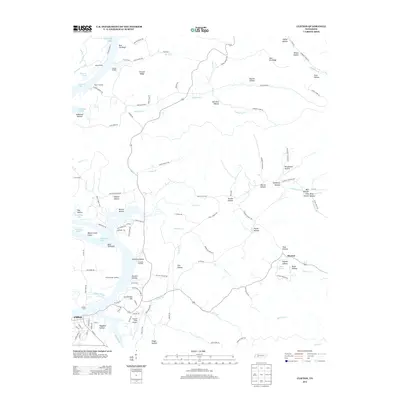
2013 Map of Clifton
USGS Topo · Published 2013About this map
Clifton serves as the focal point along the eastern shore of Kentucky Lake, where the Tennessee River broadens into a significant waterway. This 2013 survey documents a landscape defined by the winding course of the river and the numerous landings that dot its banks, including Lego Landing, Kittrell Landing, and Peters Landing. The map illustrates the transition from the riverfront to the interior hills, marked by named ridges such as Kittrell Ridge and New Era Ridge. To the south, Carrollville Hill and the Hassell Field Airport overlook the bend in the river near Clifton Ferry. The terrain is deeply dissected by a network of creeks and hollows, including Whiteoak Cr and Beech Cr, which provide a detailed view of the local drainage patterns and the rural road network that follows these natural features through the Tennessee backcountry.
Find a feature on this map
120 named features on this map. Tap any name to fly to it.
Don’t see what you’re looking for? This feature index may not catch every label — zoom into the map to look around manually.
Map Details
Editions of this 2013 Clifton Map
This is the sole edition of this map. No revisions or reprints were ever made.
Other maps of this area

1905 · Waynesboro
USGS Topo · 1:125,000

1936 · Eagle Creek
USGS Topo · 1:24,000

1936 · Olivehill
USGS Topo · 1:24,000

1936 · Bath Springs
USGS Topo · 1:24,000

1936 · Linden
USGS Topo · 1:24,000

1936 · Leatherwood
USGS Topo · 1:24,000

1936 · Clifton
USGS Topo · 1:24,000

1936 · Perryville
USGS Topo · 1:24,000

1936 · Waynesboro
USGS Topo · 1:24,000

1936 · Pope
USGS Topo · 1:24,000