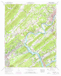
1968 Map of Clifton
USGS Topo · Published 1977About this map
The U S Atomic Energy Commission and its restricted zones dominate the southern landscape of this 1960s study, illustrating the significant federal footprint in the region. North of the City Boundary, the terrain rises toward Walden Ridge and Blackoak Ridge, where traditional Appalachian settlement patterns persist in places like Dutch Valley and Laurel Grove. The Clinch River is the central artery of the quadrangle, now backing into Melton Hill Lake behind the local dams. Industrial development is anchored by the massive Bull Run Steam Plant situated along the water's edge, while the town of Clinton serves as a commercial hub for the surrounding ridges. Dozens of small family and community burial grounds, such as Hendren Cem and Talley Cem, are scattered across the hollows, providing a wealth of detail for genealogists tracing families in the Frog Pond Valley and Poplar Creek areas.
Find a feature on this map
94 named features on this map. Tap any name to fly to it.
Don’t see what you’re looking for? This feature index may not catch every label — zoom into the map to look around manually.
Map Details
Editions of this 1968 Clifton Map
This is the sole edition of this map. No revisions or reprints were ever made.
Other maps of this area

1905 · Waynesboro
USGS Topo · 1:125,000

1936 · Eagle Creek
USGS Topo · 1:24,000

1936 · Olivehill
USGS Topo · 1:24,000

1936 · Bath Springs
USGS Topo · 1:24,000

1936 · Linden
USGS Topo · 1:24,000

1936 · Leatherwood
USGS Topo · 1:24,000

1936 · Clifton
USGS Topo · 1:24,000

1936 · Perryville
USGS Topo · 1:24,000

1936 · Waynesboro
USGS Topo · 1:24,000

1936 · Pope
USGS Topo · 1:24,000