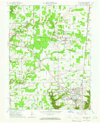
1964 Map of Clifty Falls
USGS Topo · Published 1965About this map
Clifty Falls State Park dominates the southern landscape of this mid-1960s survey, showcasing the dramatic elevation drops of Clifty Creek through a series of cascades including Little Clifty Falls, Tunnel Falls, and Hoffman Falls. The northern half of the region is defined by the massive Jefferson Proving Ground, a sprawling military installation marked by restricted gates like Gate 19 and Gate 21, and an internal Airfield.
Find a feature on this map
62 named features on this map. Tap any name to fly to it.
Don’t see what you’re looking for? This feature index may not catch every label — zoom into the map to look around manually.
Map Details
Editions of this 1964 Clifty Falls Map
3 editions found
Other maps of this area

1939 · Madison West
USGS Topo · 1:24,000

1948 · Madison West
USGS Topo · 1:24,000

1953 · Madison West
USGS Topo · 1:24,000

1953 · Madison East
USGS Topo · 1:24,000

1956 · Volga
USGS Topo · 1:24,000

1956 · Kent
USGS Topo · 1:24,000

1956 · Clifty Falls
USGS Topo · 1:24,000

1956 · Canaan
USGS Topo · 1:24,000

1956 · Louisville
USGS Topo · 1:250,000

1959 · San Jacinto
USGS Topo · 1:24,000