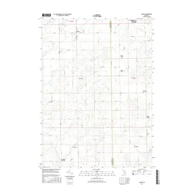
2017 Map of Climax
USGS Topo · Published 2017About this map
Climax stands at the northern edge of this township-and-range survey, serving as a focal point for the surrounding agricultural landscape of eastern Kalamazoo and western Calhoun counties. The terrain is defined by a complex drainage network where Little Portage Cr and Dorrance Cr weave between glacial depressions like Goose Pond and McGinnis Lake. This 2017 study illustrates the persistence of early settlement patterns, with rural crossroads like West Leroy and Gardners Corners remaining identifiable markers within the grid-based road system. Numerous burial grounds, including the Adams Cem and Spencer Mills Cem, are scattered across the landscape, providing essential touchstones for genealogical research. The map also records the hydrological management of the region through features like the Longman Drain and Wakeshma Drain, which support the intensive land use characterizing this part of southern Michigan.
Find a feature on this map
85 named features on this map. Tap any name to fly to it.
Don’t see what you’re looking for? This feature index may not catch every label — zoom into the map to look around manually.
Map Details
Editions of this 2017 Climax Map
This is the sole edition of this map. No revisions or reprints were ever made.
Other maps of this area

1918 · Battle Creek
USGS Topo · 1:62,500

1918 · Union City
USGS Topo · 1:62,500

1918 · Galesburg
USGS Topo · 1:62,500

1918 · Leonidas
USGS Topo · 1:62,500

1943 · Battle Creek
USGS Topo · 1:62,500

1944 · Leonidas
USGS Topo · 1:62,500

1944 · Galesburg
USGS Topo · 1:62,500

1947 · Augusta
USGS Topo · 1:24,000

1947 · Galesburg
USGS Topo · 1:24,000

1947 · Battle Creek
USGS Topo · 1:24,000