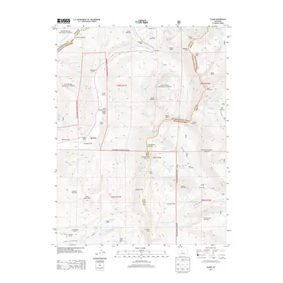
2013 Map of Climax
USGS Topo · Published 2013About this map
Fremont Pass serves as a central high-altitude junction in this 2013 topographic survey of the Colorado Rockies, where the Continental Divide separates the East Fork Eagle River from the East Fork Arkansas River. The landscape is heavily marked by industrial history and mineral extraction, evidenced by significant mining infrastructure like the Phillipson Portal, Storke Portal, and Ceresco Ridge Portal. Further south, the high-altitude drainage systems of Mosquito Creek and South Mosquito Creek reveal the remnants of early processing sites at the North London Mill and American Mill.
Find a feature on this map
74 named features on this map. Tap any name to fly to it.
Don’t see what you’re looking for? This feature index may not catch every label — zoom into the map to look around manually.
Map Details
Editions of this 2013 Climax Map
This is the sole edition of this map. No revisions or reprints were ever made.
Other maps of this area

1889 · Leadville
USGS Topo · 1:125,000

1891 · Leadville
USGS Topo · 1:125,000

1934 · Climax
USGS Topo · 1:48,000

1935 · Mount Elbert
USGS Topo · 1:62,500

1938 · Mt. Lincoln
USGS Topo · 1:48,000

1938 · Mount Elbert
USGS Topo · 1:62,500

1939 · Mount Elbert
USGS Topo · 1:62,500

1942 · Leadville
USGS Topo · 1:125,000

1945 · Mount Lincoln
USGS Topo · 1:62,500

1949 · Holy Cross
USGS Topo · 1:62,500