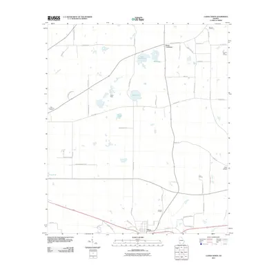
2011 Map of Climax North
USGS Topo · Published 2011About this map
Climax and the surrounding Decatur County agricultural lands are defined by a network of local family-named roads and scattered ponds that have historically sustained this corner of Georgia. The landscape is dotted with small-scale water bodies like Cane Water Pond, Black Lake, and the expansive Open Pond, reflecting the karst-like topography common to the region. Many landmarks bear the names of local families, including Parker Courthouse and Camp Flats, which provide valuable anchor points for genealogical researchers. The map is particularly notable for its high density of rural burial grounds, ranging from Mars Hill Cemetery in the north to the Fleatown Cemetery just outside the Climax town limits. These sites, alongside many family-named lanes like Tom Maxwell Rd and Le Rackley Rd, offer a detailed look at the 21st-century rural layout of a region historically tied to timber and farming.
Find a feature on this map
50 named features on this map. Tap any name to fly to it.
Don’t see what you’re looking for? This feature index may not catch every label — zoom into the map to look around manually.
Map Details
Editions of this 2011 Climax North Map
This is the sole edition of this map. No revisions or reprints were ever made.
Other maps of this area

1953 · Dothan
USGS Topo · 1:250,000

1954 · Dothan
USGS Topo · 1:250,000

1954 · Tallahassee
USGS Topo · 1:250,000

1955 · Dothan
USGS Topo · 1:250,000

1955 · Bainbridge
USGS Topo · 1:62,500

1955 · Whigham
USGS Topo · 1:62,500

1959 · Tallahassee
USGS Topo · 1:250,000

1960 · Tallahassee
USGS Topo · 1:250,000

1971 · Gee Pond
USGS Topo · 1:24,000

1971 · Vada
USGS Topo · 1:24,000