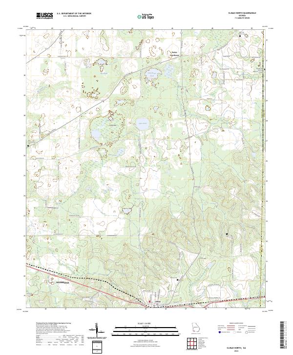
2024 Map of Climax North
USGS Topo · Published 2024About this map
Climax serves as a focal point at the southern edge of this Decatur County landscape, where the local road network converges near the border with Grady County. The terrain transitions from the low-lying wetlands of Big Slough and Gum Pond in the west to the more defined elevations of Curry Hill and Fleatown Cem toward the east. This modern survey illustrates a rural Georgia environment where agricultural lands are interspersed with namesake water bodies like Cane Water Pond and Open Pond.
Find a feature on this map
66 named features on this map. Tap any name to fly to it.
Don’t see what you’re looking for? This feature index may not catch every label — zoom into the map to look around manually.
Map Details
Editions of this 2024 Climax North Map
This is the sole edition of this map. No revisions or reprints were ever made.
Other maps of this area

1953 · Dothan
USGS Topo · 1:250,000

1954 · Dothan
USGS Topo · 1:250,000

1954 · Tallahassee
USGS Topo · 1:250,000

1955 · Dothan
USGS Topo · 1:250,000

1955 · Bainbridge
USGS Topo · 1:62,500

1955 · Whigham
USGS Topo · 1:62,500

1959 · Tallahassee
USGS Topo · 1:250,000

1960 · Tallahassee
USGS Topo · 1:250,000

1971 · Gee Pond
USGS Topo · 1:24,000

1971 · Vada
USGS Topo · 1:24,000