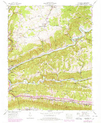
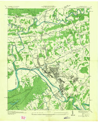
1947 Map of Clinchport
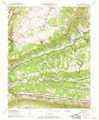
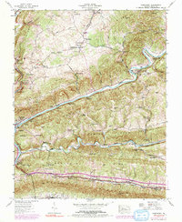
USGS Topo · Published 1978About this map
Natural Tunnel State Park dominates the western portion of this Scott County landscape, where the Southern railroad and Stock Creek pass through a massive limestone formation. The settlement of Clinchport serves as a critical junction where the railroad crosses the Clinch River, supported by an intricate system of infrastructure including the Clinchport Tunnel and the Clinchfield rail line. This post-war industrial and agricultural survey reveals a rural society built around river bends and mountain gaps, with industry represented by the Danlboone Yard and a Quarry near Pisgah Gap.
Find a feature on this map
101 named features on this map. Tap any name to fly to it.
Don’t see what you’re looking for? This feature index may not catch every label — zoom into the map to look around manually.
Map Details
Editions of this 1947 Clinchport Map
3 editions found
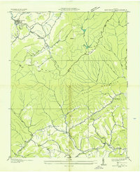
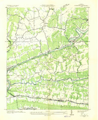
Other maps of this area

1894 · Estillville
USGS Topo · 1:125,000

1920 · Wise
USGS Topo · 1:48,000

1921 · Big Stone Gap
USGS Topo · 1:48,000

1921 · Wise
USGS Topo · 1:62,500

1922 · Big Stone Gap
USGS Topo · 1:62,500

1929 · Big Stone Gap
USGS Topo · 1:62,500

1935 · Moggasin
USGS Topo · 1:48,000
1935 · East Stone Gap
USGS Topo · 1:24,000
1935 · Kingsport
USGS Topo · 1:24,000
1935 · Clinchport
USGS Topo · 1:24,000