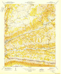
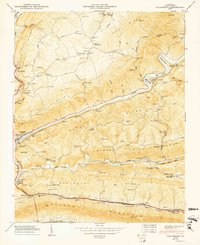
1950 Map of Clinchport
USGS Topo · Published 1950About this map
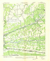
Natural Tunnel and its adjacent observation platform anchor this mid-century survey of the rugged Clinch River valley. The Southern railway and the Clinchfield lines parallel the river's winding course, threading through a series of engineering feats including the Clinchport Tunnel, Starnes Tunnel, and the Clinch Mountain Tunnel. These rail corridors served a landscape dotted with small agricultural settlements like Clinchport and Speers Ferry, where local industry relied on water power at Rhoton Mill and Spivey Mill.
Find a feature on this map
109 named features on this map. Tap any name to fly to it.
Don’t see what you’re looking for? This feature index may not catch every label — zoom into the map to look around manually.
Map Details
Editions of this 1950 Clinchport Map
2 editions found
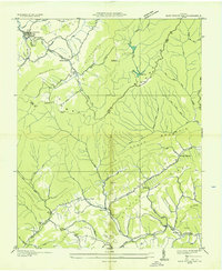
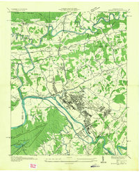
Other maps of this area

1894 · Estillville
USGS Topo · 1:125,000

1920 · Wise
USGS Topo · 1:48,000

1921 · Big Stone Gap
USGS Topo · 1:48,000

1921 · Wise
USGS Topo · 1:62,500

1922 · Big Stone Gap
USGS Topo · 1:62,500

1929 · Big Stone Gap
USGS Topo · 1:62,500

1935 · Moggasin
USGS Topo · 1:48,000
1935 · East Stone Gap
USGS Topo · 1:24,000
1935 · Kingsport
USGS Topo · 1:24,000
1935 · Clinchport
USGS Topo · 1:24,000