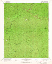
1964 Map of Clingmans Dome
USGS Topo · Published 1966About this map
Clingmans Dome stands as the central landmark of this 1960s study, marking the high-elevation divide where the Sevier Co and Swain Co line meets the Tennessee North Carolina border. This survey documents the mid-century infrastructure of the Great Smoky Mountains National Park, tracing the winding path of the Appalachian Trail as it follows high ridges through Newfound Gap and past the Lookout Tower.
Find a feature on this map
103 named features on this map. Tap any name to fly to it.
Don’t see what you’re looking for? This feature index may not catch every label — zoom into the map to look around manually.
Map Details
Editions of this 1964 Clingmans Dome Map
3 editions found
Other maps of this area

1886 · Knoxville
USGS Topo · 1:125,000

1891 · Cowee
USGS Topo · 1:125,000

1892 · Knoxville
USGS Topo · 1:125,000

1893 · Mt Guyot
USGS Topo · 1:125,000

1894 · Knoxville
USGS Topo · 1:125,000

1895 · Knoxville
USGS Topo · 1:125,000

1897 · Cowee
USGS Topo · 1:125,000

1901 · Knoxville
USGS Topo · 1:125,000

1907 · Cowee
USGS Topo · 1:125,000

1912 · Mt Guyot
USGS Topo · 1:125,000