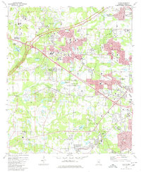
1980 Map of Clinton
USGS Topo · Published 1980About this map
Mississippi College and the Clinton Academy anchor the educational landscape of this Hinds County region, where the historical footprint of the Natchez Trace Parkway cuts diagonally across the terrain. The late twentieth-century growth of Clinton and the western edge of Jackson is evident in the dense network of schools like Eastside Sch and Magnolia Academy, alongside specialized facilities such as the U S Army Engineer Waterways Experiment Station.
Find a feature on this map
57 named features on this map. Tap any name to fly to it.
Don’t see what you’re looking for? This feature index may not catch every label — zoom into the map to look around manually.
Map Details
Editions of this 1980 Clinton Map
3 editions found
Other maps of this area

1903 · Jackson
USGS Topo · 1:125,000

1905 · Jackson
USGS Topo · 1:48,000

1906 · Florence
USGS Topo · 1:62,500

1908 · Jackson
USGS Topo · 1:62,500

1908 · Florence
USGS Topo · 1:62,500

1934 · Raymond
USGS Topo · 1:48,000

1937 · Raymond
USGS Topo · 1:62,500

1937 · Terry
USGS Topo · 1:48,000

1942 · Raymond
USGS Topo · 1:62,500

1943 · Terry
USGS Topo · 1:62,500