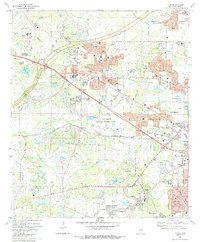
1980 Map of Clinton
USGS Topo · Published 1988About this map
Clinton and the western edge of Jackson define this landscape during a period of significant suburban expansion in Hinds County. The map documents the intricate transportation corridor where the Natchez Trace Parkway and the Illinois Central Gulf railroad intersect, alongside newer interstate infrastructure. Educational and social institutions are prominent, from the historic Clinton Academy and Sumner Hill Sch to the Reformed Theological Seminary and the Baptist Childrens Village.
Find a feature on this map
68 named features on this map. Tap any name to fly to it.
Don’t see what you’re looking for? This feature index may not catch every label — zoom into the map to look around manually.
Map Details
Editions of this 1980 Clinton Map
3 editions found
Other maps of this area

1903 · Jackson
USGS Topo · 1:125,000

1905 · Jackson
USGS Topo · 1:48,000

1906 · Florence
USGS Topo · 1:62,500

1908 · Jackson
USGS Topo · 1:62,500

1908 · Florence
USGS Topo · 1:62,500

1934 · Raymond
USGS Topo · 1:48,000

1937 · Raymond
USGS Topo · 1:62,500

1937 · Terry
USGS Topo · 1:48,000

1942 · Raymond
USGS Topo · 1:62,500

1943 · Terry
USGS Topo · 1:62,500