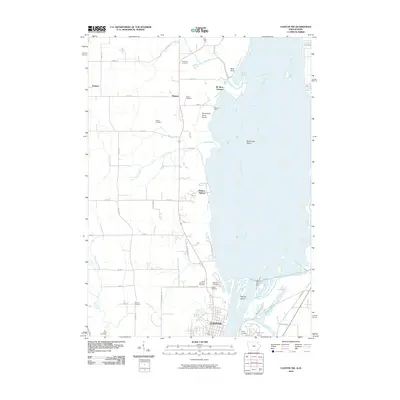
2010 Map of Clinton NW
USGS Topo · Published 2010About this map
The northern edge of Clinton meets the complex waterways of the Mississippi River in this 2010 survey. The landscape transitions from the dense street grid of the city to the fertile agricultural plains of northern Clinton County, where the small settlements of Andover and Almont serve as local anchors. This survey is particularly valuable for its density of burial sites, including the Oakland Cemetery, Calvary Cemetery, and Saint Boniface Cemetery located near the city, as well as outlying family and rural grounds like Dierks Cemetery and Hauntown Cemetery. Along the river, the geography is defined by a network of chutes and backwaters, such as Lyons Chute and Cattail Slough, surrounding features like Stamps Island and Woodruffs Island. Further inland, the map captures the transition from high ground at Bald Point to the broad Pomme de Terre Prairie, shaped by the meandering paths of Elk River and Silver Creek.
Find a feature on this map
46 named features on this map. Tap any name to fly to it.
Don’t see what you’re looking for? This feature index may not catch every label — zoom into the map to look around manually.
Map Details
Editions of this 2010 Clinton NW Map
This is the sole edition of this map. No revisions or reprints were ever made.
Other maps of this area

1891 · Clinton
USGS Topo · 1:62,500

1892 · Goose Lake
USGS Topo · 1:62,500

1892 · Savanna
USGS Topo · 1:62,500

1894 · Goose Lake
USGS Topo · 1:62,500

1894 · Clinton
USGS Topo · 1:62,500

1899 · Clinton
USGS Topo · 1:125,000

1935 · Miles
USGS Topo · 1:62,500

1941 · Miles
USGS Topo · 1:62,500

1952 · Clinton
USGS Topo · 1:62,500

1952 · Savanna
USGS Topo · 1:62,500