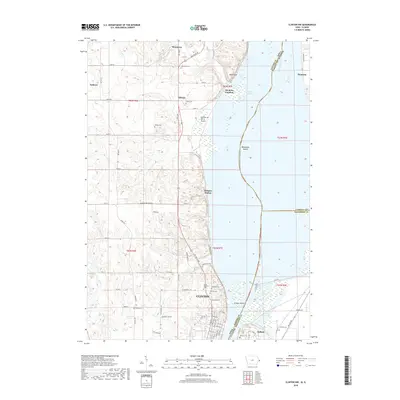
2018 Map of Clinton NW
USGS Topo · Published 2018About this map
The Mississippi River creates a complex boundary between Iowa and Illinois on this 2018 survey, defining a landscape of sprawling wetlands and riverine islands. Along the western banks, the northern reaches of Clinton are visible, where the residential grid meets cemeteries such as Saint Boniface Cem and Oakland Cem. The terrain rises to the west into a series of hollows and ridges, most notably Bulgers Hollow, while the river itself is dotted with features like Woodruffs Island and Stamps Island.
Find a feature on this map
69 named features on this map. Tap any name to fly to it.
Don’t see what you’re looking for? This feature index may not catch every label — zoom into the map to look around manually.
Map Details
Editions of this 2018 Clinton NW Map
This is the sole edition of this map. No revisions or reprints were ever made.
Other maps of this area

1891 · Clinton
USGS Topo · 1:62,500

1892 · Goose Lake
USGS Topo · 1:62,500

1892 · Savanna
USGS Topo · 1:62,500

1894 · Goose Lake
USGS Topo · 1:62,500

1894 · Clinton
USGS Topo · 1:62,500

1899 · Clinton
USGS Topo · 1:125,000

1935 · Miles
USGS Topo · 1:62,500

1941 · Miles
USGS Topo · 1:62,500

1952 · Clinton
USGS Topo · 1:62,500

1952 · Savanna
USGS Topo · 1:62,500