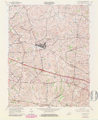
1965 Map of Clintonville
USGS Topo · Published 1984About this map
The Lexington Blue Grass Army Depot dominates the central landscape of this Kentucky survey, highlighting the military infrastructure situated between the Bourbon, Clark, and Fayette county lines. This mid-century view captures a transition from traditional rural hamlets to modernized transportation corridors. The regional rail economy is clearly mapped through the intersecting routes of the Chesapeake and Ohio and the Louisville and Nashville railroads, which served scattered communities like Avon, Clintonville, and Chilesburg.
Find a feature on this map
43 named features on this map. Tap any name to fly to it.
Don’t see what you’re looking for? This feature index may not catch every label — zoom into the map to look around manually.
Map Details
Editions of this 1965 Clintonville Map
3 editions found
Other maps of this area

1892 · Richmond
USGS Topo · 1:125,000

1897 · Richmond
USGS Topo · 1:125,000

1927 · Lexington
USGS Topo · 1:48,000

1929 · Lexington
USGS Topo · 1:62,500

1950 · Lexington East
USGS Topo · 1:24,000

1952 · Paris East
USGS Topo · 1:24,000

1952 · Coletown
USGS Topo · 1:24,000

1952 · Clintonville
USGS Topo · 1:24,000

1952 · Austerlitz
USGS Topo · 1:24,000

1952 · Ford
USGS Topo · 1:24,000