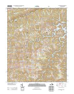
2013 Map of Clintwood
USGS Topo · Published 2013About this map
Clintwood serves as the focal point of this Dickenson County landscape, where the confluence of numerous hollows and ridges dictates the settlement pattern. The town’s street-level detail reveals a dense network including Main St, Market St, and residential corridors like Happy Valley Dr. Outside the town center, the terrain is defined by a succession of gaps and ridges, such as Grassy Gap and Maynard Ridge, which channel the flow of the Pound River as it meanders through the eastern portion of the quadrangle.
Find a feature on this map
120 named features on this map. Tap any name to fly to it.
Don’t see what you’re looking for? This feature index may not catch every label — zoom into the map to look around manually.
Map Details
Editions of this 2013 Clintwood Map
This is the sole edition of this map. No revisions or reprints were ever made.
Other maps of this area

1886 · Grundy
USGS Topo · 1:125,000

1890 · Whitesburg
USGS Topo · 1:125,000

1890 · Grundy
USGS Topo · 1:125,000

1892 · Grundy
USGS Topo · 1:125,000

1892 · Whitesburg
USGS Topo · 1:125,000

1912 · Pound
USGS Topo · 1:48,000

1913 · Clintwood
USGS Topo · 1:62,500

1914 · Pound
USGS Topo · 1:62,500

1914 · Vergie
USGS Topo · 1:48,000

1915 · Clintwood
USGS Topo · 1:62,500