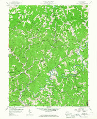
1957 Map of Clio
USGS Topo · Published 1967About this map
Big Sandy Creek winds through the border of Roane and Kanawha counties, anchoring a landscape defined by deep-cut hollows and small, creek-side settlements. This mid-century survey reveals the heavy influence of the energy industry on the region, most notably across the Stringtown Oil Field and the numerous wells scattered along Hurricane Creek. These industrial sites sit alongside established rural institutions, from the Jackson Union Sch in the north to Osbornes Mills near the southern bend of the creek.
Find a feature on this map
100 named features on this map. Tap any name to fly to it.
Don’t see what you’re looking for? This feature index may not catch every label — zoom into the map to look around manually.
Map Details
Editions of this 1957 Clio Map
3 editions found
Other maps of this area

1897 · Kanawha Falls
USGS Topo · 1:125,000

1900 · Kanawha Falls
USGS Topo · 1:125,000

1901 · Kanawha Falls
USGS Topo · 1:125,000

1906 · Otter
USGS Topo · 1:62,500

1906 · Walton
USGS Topo · 1:62,500

1907 · Otter
USGS Topo · 1:62,500

1907 · Walton
USGS Topo · 1:62,500

1907 · Clendenin
USGS Topo · 1:62,500

1908 · Clay
USGS Topo · 1:48,000

1909 · Clendenin
USGS Topo · 1:62,500