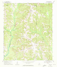
1969 Map of Clopton
USGS Topo · Published 1971About this map
The rolling hills and creek-dissected plateaus of southeast Alabama define this landscape where Barbour and Henry counties meet. The settlement of Clopton serves as a central hub for a network of rural crossroads and community centers including Barefield Crossroads and Bertha. The terrain is heavily defined by the winding course of the Choctawhatchee River and its West Fork, which drain the numerous branches and creeks that separate family-named landmarks and rural congregations. Genealogy researchers will find significant detail in the placement of country churches such as Penile Ch, Mt Carmel Ch, and Wesley Chapel. The map reveals a land use pattern of small-scale agriculture and timber, with isolated cemeteries like Magnolia Cem and Salem Cem preserving the locations of the area's earliest homesteads. These rural outposts are connected by improved and unimproved roads, showing the region's development just before the modern era.
Find a feature on this map
38 named features on this map. Tap any name to fly to it.
Don’t see what you’re looking for? This feature index may not catch every label — zoom into the map to look around manually.
Map Details
Editions of this 1969 Clopton Map
2 editions found
Other maps of this area

1942 · Enterprise
USGS Topo · 1:125,000

1948 · Ozark
USGS Topo · 1:62,500

1950 · Ozark
USGS Topo · 1:62,500

1953 · Dothan
USGS Topo · 1:250,000

1954 · Dothan
USGS Topo · 1:250,000

1955 · Dothan
USGS Topo · 1:250,000

1960 · Ewell
USGS Topo · 1:24,000
1962 · Ewell
USGS Topo · 1:25,000

1969 · Abbeville West
USGS Topo · 1:24,000
1969 · Clio
USGS Topo · 1:24,000