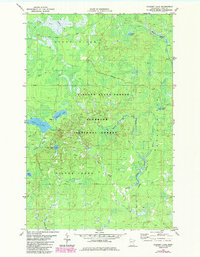
1982 Map of Cloquet Lake
USGS Topo · Published 1985About this map
The intersection of Finland State Forest and Superior National Forest defines this northern landscape, which was updated in the mid-1980s. The map illustrates a dense hydrographic network including Cloquet Lake, Katherine Lake, and the headwaters of the Cloquet River. The terrain is characterized by its seasonal accessibility, indicated by a designated Winter Trail and several Snowmobile Trails that weave through the forest and around smaller water bodies like Sink Lake and Drake Lake. While largely wild, evidence of human resource use appears in the form of a Gravel Pit near the shoreline of Cloquet Lake. The hydrology is particularly detailed, tracing the winding paths of the Beaver River and its East Branch, along with Ekbeck Creek and Beaver Creek feeding into isolated basins like Ferman Lake.
Find a feature on this map
21 named features on this map. Tap any name to fly to it.
Don’t see what you’re looking for? This feature index may not catch every label — zoom into the map to look around manually.
Map Details
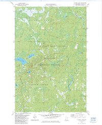
Editions of this 1982 Cloquet Lake Map
2 editions found
Other maps of this area

1953 · Whyte
USGS Topo · 1:62,500

1954 · Greenwood Lake
USGS Topo · 1:62,500

1954 · Silver Bay
USGS Topo · 1:62,500

1954 · Two Harbors
USGS Topo · 1:250,000

1955 · Isabella
USGS Topo · 1:62,500

1957 · Two Harbors
USGS Topo · 1:250,000

1958 · Two Harbors
USGS Topo · 1:250,000

1964 · Two Harbors
USGS Topo · 1:250,000

1976 · Two Harbors
USGS Topo · 1:100,000
1981 · Legler Lake
USGS Topo · 1:24,000
Featured Places
- Silver Creek Township, MN
- Stony River Township, MN
- Beaver Bay Township, MN
- Lake County, MN
- United States